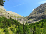
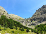
Waterfall of Cimet
Hiking itinerary, Course
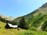
Val d?Allos ? Le village
 Departure/Arrival
 Point of interest
Circuit n° 1
- Route :
- Route 400
- Distance (km) 21
- Elevation (m) 400
- Daily duration (minutes) 360
- Route 2090
- Route 2385
Presentation
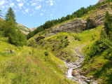
Beautiful view on the Waterfall of Pich and ascent up to the Waterfall of Cimet via the Vacheresse forest and Talon forest house.
From the barrier of the Vacheresse Wood, you will discover a varied walk bringing you up to the waterfall of Pich,in the heart of the National park of Mercantour and continue, for the most sports, direction the waterfall of Cimet
From 01/05 to 03/11 daily.
Informations
- Sitra promotion typology :
- Not recommended in bad weather
Good to know
- Services :
- animal forbidden
Pics